

 See the bike rental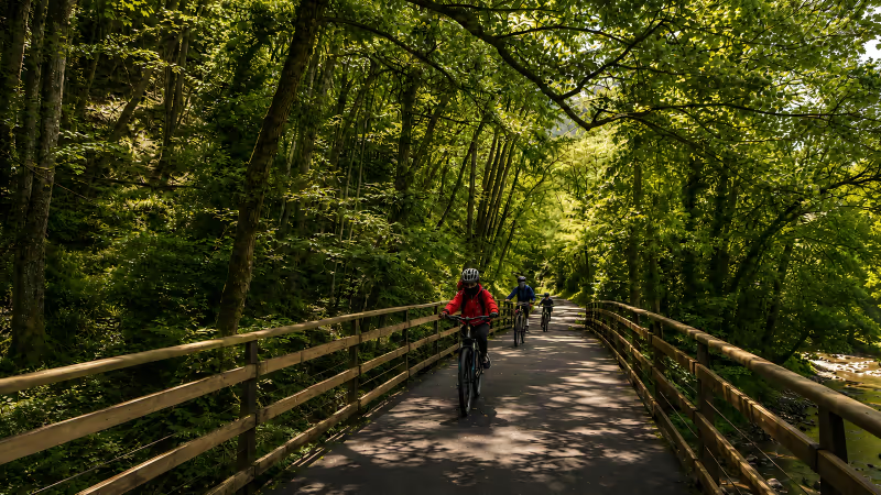
The Entrago - Caranga section concentrates the longest tunnels of the Senda del Oso: about 12 km on a gentle 1.5% descent, with no cars, a dozen galleries and the biggest close to 300 metres.
Distance and difficulty
The Entrago - Caranga section adds up to about 12 kilometres: it leaves km 0 of the Senda del Oso, beside the Entrago car park (Teverga), and ends at the Peñas Juntas gorge, at km 12, where Caranga links up with the Quirós branch.
The difficulty is low: an average gradient of 1.5%, a compacted-gravel surface and zero cars, because the greenway always runs separate from the road.
Ride it Entrago to Caranga, not the other way round. Entrago sits higher, so this route is the first half of the classic bike descent, the 18 km from Entrago to Buyera with about 200 metres of downhill in your favour, completed in 2-3 hours with stops.
At that pace, the 12 km to Caranga come out at around an hour and a half.
On foot the approach changes, because 12 km one way means returning the same way or timing the bus back. If you are walking, the circular routes we suggest in the guide to the trail on foot pay off more in this valley; for times across all sections, check how long it takes.
About 12 km
The first half of the trail's classic descent.
- Start: Entrago, km 0 of the trail
- Finish: Caranga, Peñas Juntas gorge (km 12)
1.5% gradient
Downhill from Entrago, without a single ramp that forces you off.
- Compacted-gravel surface
- No traffic: the greenway runs separate from the road
A dozen tunnels
The long galleries of the mining railway, lit with solar lamps.
- The biggest, about 300 m
- 4-5 degrees cooler than outside
1.5 h by bike · 3 h on foot
Approximate times with stops.
- By bike, at the pace of the classic descent
- On foot, at full-trail pace (22 km in 5-6 h)
What to see along the way
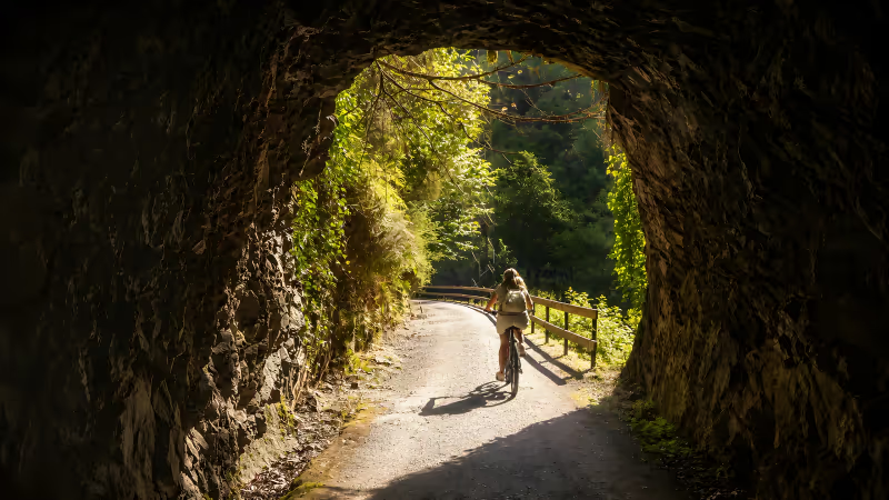
What defines this section is the tunnels: the Teverga branch concentrates around a dozen of the 30-plus galleries the mining railway bored through the limestone of the valley.
Here you will also find the biggest on the whole trail, about 300 metres long with side openings over the river that ventilate the passage and let in some light.
The tunnels are lit with solar lamps that switch on as you pass, though the lighting can fail after several very overcast days.
Bring a headlamp or bike lights and a thin extra layer, because inside, the temperature drops 4-5 degrees compared with outside — a relief at the height of August. The full kit is in our list of what to pack for the route.
The long tunnels are here, not on the northern trunk. If you are only doing one section of the trail with kids, this is the one that delivers the most: a steady 1.5% descent, galleries up to 300 metres and the Prehistory Park at km 2.
The Prehistory Park of Teverga sits at km 2, the obvious stop if you are pedalling with children. The section's landmarks, in riding order, are these:
- Km 0: Entrago, start of the trail and main car park.
- Km 2: Prehistory Park of Teverga.
- Tunnels of the Teverga branch: a dozen galleries, the biggest about 300 m.
- Km 12: Peñas Juntas gorge and Caranga, junction with the Quirós branch.
The route follows the mining railway that carried coal from Teverga and Quirós down to Trubia: proposed in 1863, opened in 1884 with a 750 mm narrow gauge and closed in 1963. In its best year, 1912, it moved 33,000 tonnes with 244 workers.
The Caranga - Entrago stretch was recovered as a greenway in 1996, a year after the first sector between Tuñón and Proaza opened.
The finale arrives with the Peñas Juntas gorge, where the limestone closes in over the river just before Caranga.
There the trail forks: the Quirós branch, opened in 1999, climbs 8-10 km to Santa Marina, and the main trunk continues towards Proaza (km 14, with the village centre 200 metres from the trail) and the Valdecerezales area, at km 15.
If you carry on north, the iron bridges at km 16, the Buyera recreation area and the bear enclosure await: we cover them in the Tuñón - Proaza section guide. To fit it all into a day plan, lean on the route map.
How to get to the start
The starting point is Entrago, in the municipality of Teverga, 40 km from Oviedo. By car it is about 45 minutes on the A-63 to exit 9 (Trubia) and then the AS-228 up the valley; from Gijón allow 70 km and an hour, and from León, 85 km and 1 h 15 via the AP-66 and the Ventana pass.
To leave the car, Entrago offers about 60 free spaces, the largest car park on the whole trail. In July, August and on long weekends it fills up before 10:00, so arrive early or go through the alternatives in the parking guide.
Without a car, the Oviedo - San Martín de Teverga bus line takes about 55 minutes and stops in Tuñón, Proaza, Caranga and Entrago, which lets you ride the section one way and return by bus.
Timetables change by season and are published by the Asturias Transport Consortium. The nearest train station is Trubia, 25 km from Entrago.
If you come without a bike, the pick-up point for the rental is in Entrago itself, at Polígono de Pradacón, Nave 1. The full-day rate for the adult model is €28 and includes helmet, insurance, map, assistance and the transfer back from Buyera; the rest of the options are on the prices page.
Questions about the section
About 12 km. Entrago is km 0 of the Senda del Oso and the Peñas Juntas gorge, at Caranga, falls at km 12. It is the first half of the classic 18 km descent to Buyera.
No. The average gradient is 1.5%, the surface is compacted gravel and no cars use it. From Entrago it is a gentle descent, suitable for children and for adults who rarely pedal.
This Teverga branch concentrates around a dozen of the trail's 30-plus tunnels. The biggest is close to 300 metres and they are lit with solar lamps, though a headlamp is a good idea.
Entrago has about 60 free spaces, the largest car park on the trail. In July, August and on long weekends it fills up before 10:00, so come early or consider arriving on the local bus.
Yes. The Oviedo - San Martín de Teverga bus line takes about 55 minutes and stops in Tuñón, Proaza, Caranga and Entrago. Timetables change by season and are published by the Asturias Transport Consortium.
 Ruta del Oso