

 See the bike rental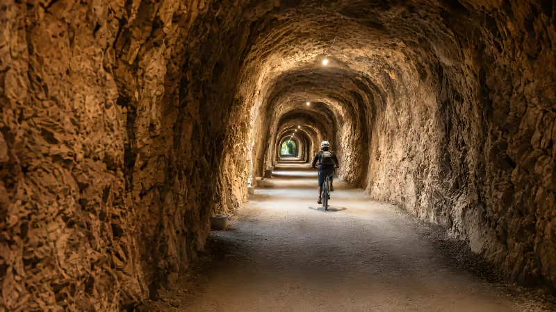
The difficulty of the Ruta del Oso is low: 22 km with an average gradient of 1.5%, compacted gravel and not a single car. Here is the real level of each section and which distance suits your fitness.
Elevation and surface type
The trail has an average gradient of 1.5% and a compacted-gravel surface, wide, even and closed to traffic. Those two facts explain its reputation as an easy route: there are no ramps that force you off the bike and no technical passages where you have to watch your footing.
The reason lies in its origin. The trail follows the course of the Teverga mining railway, opened in 1884 with a 750 mm narrow gauge, and a convoy loaded with coal could not handle climbs: the elevation is spread almost imperceptibly across the 22 km separating Entrago (km 0) from Tuñón (km 22).
The profile also plays in your favour if you start from Entrago: down to the Buyera recreation area (km 18) you accumulate about 200 metres of descent spread over 18 km. In the opposite direction the climb exists, but at a 1.5% average you pedal it seated and on foot you hardly notice it.
Tunnels and ground conditions
Along the way you cross more than 30 tunnels inherited from the railway: between 6 and 8 exceed 150 metres and the biggest is close to 300. They are lit with solar lamps and inside, the temperature drops 4-5 degrees — a relief in mid-July and a reason to carry an extra layer in spring and autumn.
The compacted gravel rolls well under any city, hybrid or children's bike, and takes pushchairs as long as they are all-terrain with wheels of 30 cm or more.
The Quirós branch (Caranga–Santa Marina, 8-10 km, opened in 1999) completes a network of about 30 km with the same greenway character; the official datasheet of the itinerary is at viasverdes.com.
Level by section
No section of the trail goes beyond the easy level; what really changes from one to another is the distance. The table summarises the level in the Entrago–Tuñón direction, which keeps the gradient in your favour.
| Section | Distance | Profile | Level |
|---|---|---|---|
| Entrago → Proaza (km 0-14) | 14 km | Gentle descent, gorge and most of the tunnels | Easy |
| Proaza → Buyera (km 14-18) | 4 km | Practically flat: Valdecerezales and iron bridges | Very easy |
| Buyera → Tuñón (km 18-22) | 4 km | Flat, with the bear enclosure at km 19 | Very easy |
| Quirós branch (Caranga → Santa Marina) | 8-10 km | The quietest arm of the network | Easy |
The points of interest set the pace as much as the profile: the Prehistory Park sits at km 2, the Peñas Juntas narrows at km 12 and Proaza at km 14, with the village centre 200 metres from the trail.
That central stretch is the most spectacular of the route, not the hardest. If you want the detail of the northern end, the Tuñón–Proaza section guide has its own page.
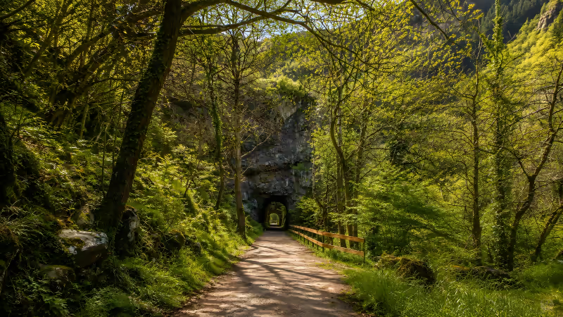
On foot, difficulty is better measured in hours than in elevation. The Proaza circular is 5 km and an hour and a half; the Tuñón one, 10 km and about 3 hours; Entrago–Buyera, 18 km in 4-5 hours; and the full trail, 22 km in 5-6 hours. All the times are broken down in the guide to how long the Ruta del Oso takes.
Recommendations by fitness level
The trail welcomes almost everyone if you choose your kilometres well; that is the only decision that matters. These are our recommendations, with specific distances and times for each profile.
- Low fitness or small children: the stroll from Buyera to the bear enclosure is 0.8 km and 20 minutes each way, and the Proaza circular, 5 km in an hour and a half. If you are walking as a family, the guide to the trail on foot with kids closes the plan for you.
- Normal fitness, no training: the classic plan by bike. Entrago–Buyera is 18 km of gentle descent with 200 metres in your favour, 2-3 hours with stops, leaving between 10 and 11. The bike rental costs €28 a day (€50 for the e-bike) and includes helmet, insurance and the transfer back from Buyera, so you never even touch the climb.
- Regular walkers: the full trail, 22 km in 5-6 hours, best from Entrago to Tuñón to keep the gradient in your favour. The detour to the pre-Romanesque church of Tuñón (year 891) adds only 300 metres.
- Good fitness: add the Quirós branch and complete the network of about 30 km; by bike, riding every branch out and back can reach 60 km in a day.
Elevation is not the challenge on this route: at a 1.5% average, the real difficulty is choosing the distance well. Between the 0.8 km stroll to the enclosure and the 60 km of the full network out and back, there is a plan for every level of fitness.
The time of year weighs as much as the profile.
May-June and September give the best conditions; in July and August it pays to start early, because the car parks at Entrago (about 60 spaces) and Tuñón (about 40) fill up before 10:00, and the cool hours are also the ones with the highest chance, around 70%, of seeing Molina the bear from the free viewpoint at the enclosure.
In winter there are frosts and only sunny days are worth it; the month-by-month breakdown is in the best time to do the route.
One final note if you are not coming alone: with a dog, the lead is compulsory along the whole trail and the Entrago–Proaza section offers 80% shade and fountains in Entrago, Proaza, Buyera and Tuñón. The full conditions, including the mastiffs guarding herds near Proaza, are in the guide to the route on foot with a dog.
 Ruta del Oso